
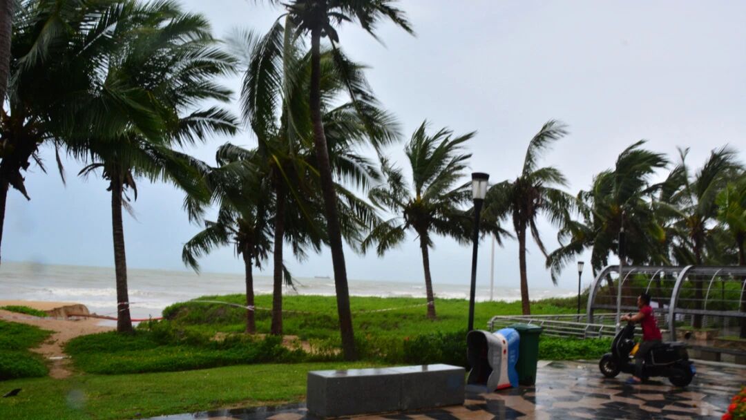
China’s National Meteorological Center (NMC) rolled out a blue typhoon alert at 6 a.m. on Saturday, predicting that Maysak, the 10th typhoon to form this year, will make its second landfall overnight on Saturday along the coastal zone straddling south China’s Guangxi Zhuang Autonomous Region and northern Vietnam. In response to the incoming storm, multiple areas in Guangxi have already banned all ship voyages and shut down all marine leisure and entertainment activities.
As reported by China Central Television (CCTV) on Saturday, the State Flood Control and Drought Relief Headquarters has maintained a Level IV emergency response for flood and typhoon disasters covering three key south Chinese regions: Hainan Province, Guangxi Zhuang Autonomous Region and Guangdong Province.
On-site task forces sent by the Headquarters’ office are still stationed in Hainan and Guangxi, offering on-the-spot assistance and professional guidance for local disaster prevention and mitigation work. The severe typhoon is set to bring unprecedented rainfall for the current season to parts of Guangxi. Hydrological forecasts indicate that the Xijiang River and its affiliated tributaries will likely surpass their flood warning levels, posing significant flood threats to the entire Pearl River basin.
Per NMC’s meteorological forecasts, Guangxi will be battered by continuous strong winds and torrential rain for three consecutive days, with the most intense downpours scheduled to kick off on Saturday night.
Extensive heavy rainfall will blanket major Guangxi cities including Nanning, Beihai and Guilin, with certain zones facing risks of heavy downpours and even extreme rainstorms. Meanwhile, the region’s coastal areas will endure sustained gales of scale 7 to 8, with instantaneous wind gusts peaking at scale 9 to 10.
Xinhua News Agency confirmed on Saturday that Guangxi has upgraded its emergency response for severe meteorological disasters induced by the typhoon to Level III, launching full-scale emergency preparedness across the entire region.
Qi Kunyuan, head of the Qisha Maritime Station in Fangchenggang City, stated in an interview with Xinhua that the maritime authority has suspended all passenger ships, ferries and yachts within its jurisdiction and halted all offshore recreational activities. He further noted that vessels transporting dangerous goods have finished unloading all cargoes completely, ensuring no hazardous materials are left docked at ports to eliminate potential safety hazards.
Hainan’s meteorological authorities renewed a Level III typhoon warning at 9:20 a.m. on Saturday. The updated alert warned of non-stop heavy rain and gales across the province throughout the day, with cumulative rainfall expected to exceed 200 millimeters. Coastal lands and adjacent offshore waters around Hainan will be swept by scale 8 to 10 sustained winds, with maximum gusts reaching scale 11. In tandem with the typhoon alert, a yellow early warning for geological disaster risks has also been issued for Hainan Province.
The typhoon first made landfall on Hainan’s coastline on Friday evening, triggering a series of emergency suspensions across the province. Local authorities halted all train, ferry and flight services, while multiple schools suspended in-person classes. All rail routes connecting Hainan Island were closed from Friday to Saturday due to the storm’s impact. According to reports from chinanews.com, Sanya Phoenix International Airport had canceled 92 flights as of 11:30 a.m. on Friday. Key scenic spots in Sanya, such as the Wuzhizhou Island tourist resort, remained closed to visitors on Saturday.
In Guangdong Province, local emergency management departments had completed the evacuation of 23,296 people by Friday evening, as announced via the official WeChat account of the Guangdong Department of Emergency Management. The evacuation group included 10,717 offshore workers and 12,579 onshore residents, a proactive measure to avoid typhoon-related dangers.
The NMC also reminded the public that south China’s coastal regions will experience intense and widespread rainfall over the three days starting from Saturday, with individual areas likely to be hit by extreme rainstorms amid the influence of Typhoon Maysak.